 |
Cranbrook Airport
The City of Cranbrook entered the age of flight on the occasion of
the first ever flight across the Canadian Rockies on
August 2, 1919. Captain Ernest C. Hoy, DFC, landed near
Cranbook, delivered some letters to dignitaries from
counterparts in Vancouver, Vernon and Grand Forks, and
took off again for Lethbridge after refuelling.
Return to
map
|
|
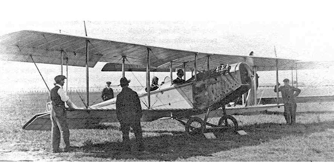
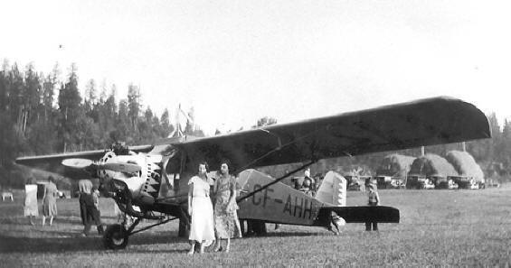
In the following years, the occasional
airborne visitors landed at the the Cominco
Marysville property or at Wasa. By April
1929, there was enough interest in aviation
that the Board of Trade announced its
intention to build an airport just north of
the city. The next month
Squadron Leader
�Tuddy� Tudhope, Superintendent of Airways
with the Civil Aviation Branch of National
Defence arrived in a Pitcairn Mailwing to
inspect the site. Locals pitched in quickly
to bring the field up to the required
standard.
|
 |
|
 |
 |
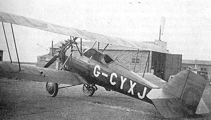
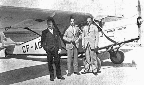
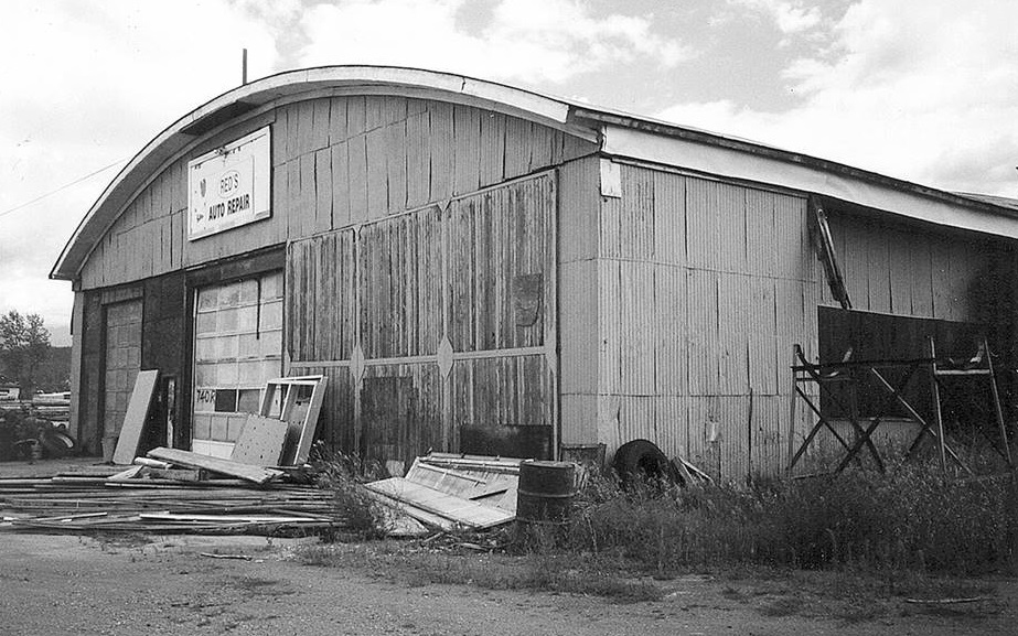
The original
hangar on the field (photographed here
in 1998) might have sheltered aircraft
like the deHavilland Puss Moth or the
Curtiss Robin C-1.
By the
start of
World War II, the runway had been
extended to 3770 feet and had its own
radio range to facilitate navigation and
landings in inclement weather.
|
|
|
|
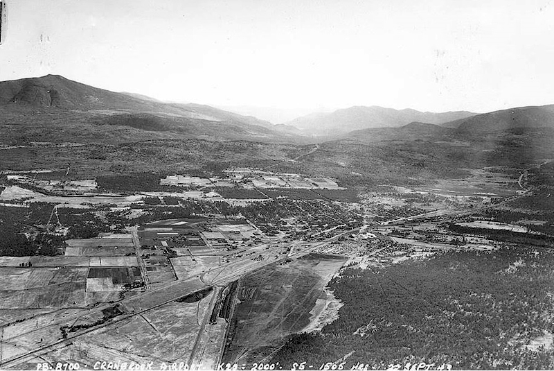
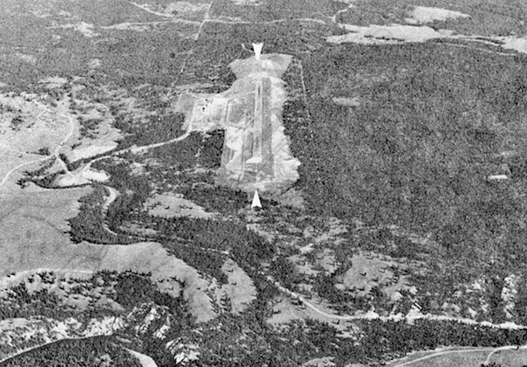
The RCAF placed a detachment
of 124 (Ferry) Squadron at Cranbrook in 1942 to support
operations ferrying military aircraft across Canada.
This 1943 view of the field clearly shows the proximity
of the airport to the City.
Back to top of
page
Return to
map
|
 |
|
. |
|
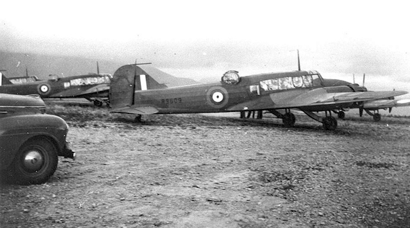
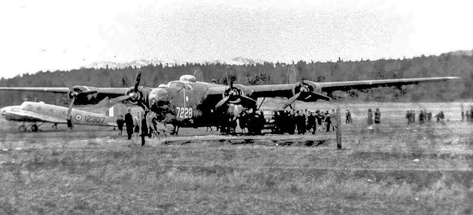
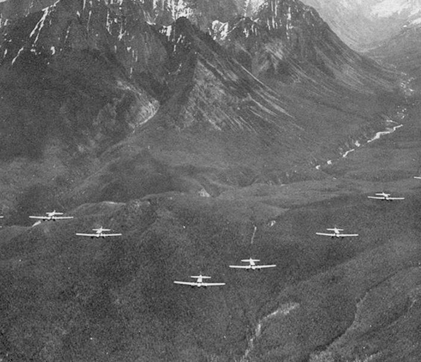
Wartime
visitors included a variety of RCAF aircraft on training
and ferry flights, like these Ansons, as well as the
occasional USAF aircraft. The B-24 Liberator shown in
the photo below was fortunate to land without damage in
adverse weather on the night of March 14, 1945 after
becoming lost during a mission from its base in Boise,
Idaho.
|
|
|
|
 |
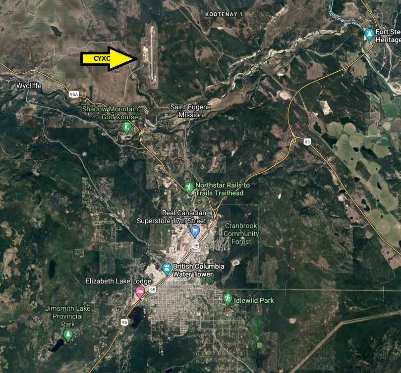
At the end of the war,
Canadian Pacific Airlines began scheduled DC-3 service
to Cranbrook, precipitating further improvements to the
runways and facilities. In 1968, recognizing the need
for more space than the existing airport offered, the
Department of Transport developed a new airport eight
kilometres north of Cranbrook with a paved 6,000 foot
runway.
Back to top of
page
Return to
map
|
|
. |
|
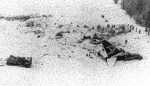
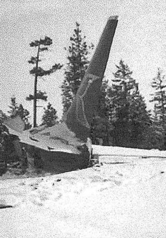
On February 11, 1978, YXC
was the site of a major accident when a Pacific Western
Airlines Boeing 737 crashed during an attempted
go-around after encountering a snow plow on the runway.
A thrust reverser malfunction resulted in the deaths of
42 crew and passengers.
Back to top of
page
Return to
map |
 |
|
Note: All photos courtesy Chris
Weicht -
current aerial view courtesy
Google Maps
 �
British Columbia Aviation Museum Updated:
2023-01-16 �
British Columbia Aviation Museum Updated:
2023-01-16
|