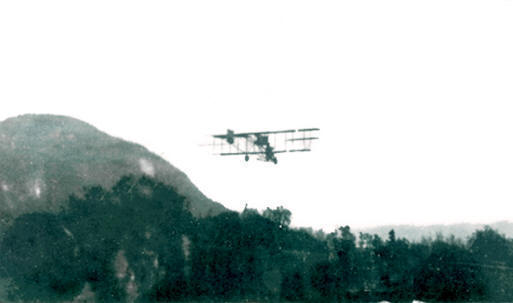
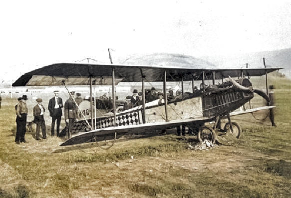
A photo in the Penticton
archives shows a Curtiss Pusher biplane claimed to be
over Penticton in 1917, although the facts (including
dates) behind the picture remain uncertain in the
absence of related documentation.
Return to
map
|
. |
|
. |
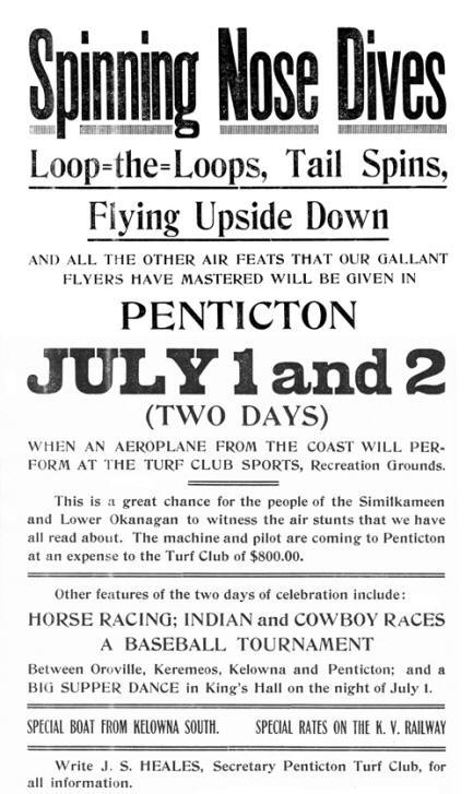
The next documented visit was by a Curtiss JN-4
Canuck in late June 1919 which put up an aerial
display and offered rides from the Turf Club
Sports grounds. The promotional poster says it
all!
|
 |
A third visit
occurred shortly after when Lt. Ernie Hall, a
competitor in the race to make the first
crossing of the Rockies by air between Vancouver
and Calgary, landed on August 4th in
a JN-4 belonging to the Vancouver Aerial
Transportation Company. Lt. Hall�s bid was
later ended when he crashed at Creston.
|
|
. |
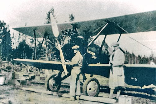
The
next recorded landing was of a barnstorming Yukon
Airways Eaglerock in September 1928, en route to the
Yukon, the first of a series of visits by transient
aircraft.
|
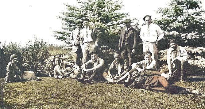
A standout was the 1932 air
show organized by the Aero Club of BC and offered from a
meadow south of Queens Park. The post-show celebrations
were made especially noteworthy when three members of
the aircrew, shown here, were caught skinny dipping in
the pool at the Aquatic Club.
Although used for the
airshow, the meadow was too short to support regular
flying operations and the City council began to explore
other options for location of a permanent airdrome.
.Return to
map |
.
|
|
. |
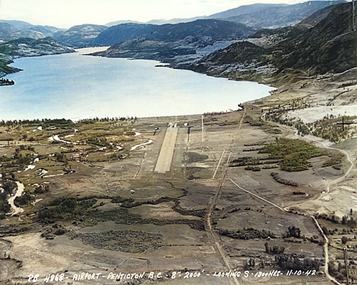
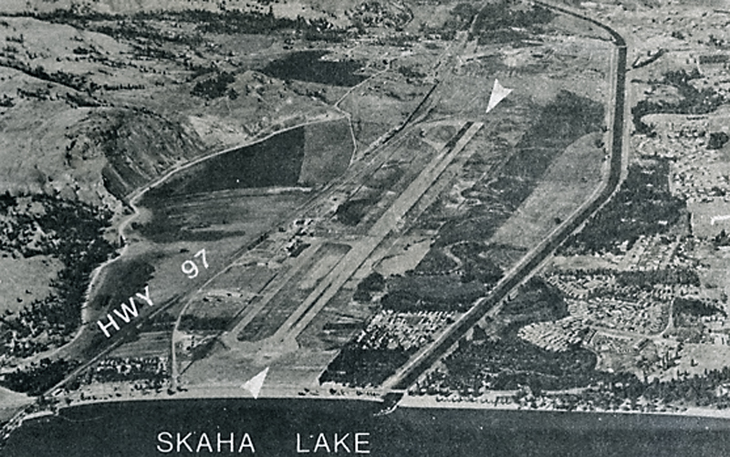
In
1937, a Civil Aviation Branch inspector
recommended a location west of the Okanagan
River and north of Skaha Lake, on the
traditional land of the
SnPink'tn (Penticton Indian
Band). The land was leased from the
Department of Indian Affairs and
construction plans put into place alongside
plans to implement commercial air services
through the Okanagan. This 1942 aerial
photo, looking south, shows the first stage
of completion of the field. This included a
seaplane base on the lake foreshore.
Airfield
construction received increased priority
with the start of World War II and Penticton
received funding for a number of upgrades.
|
|
. |
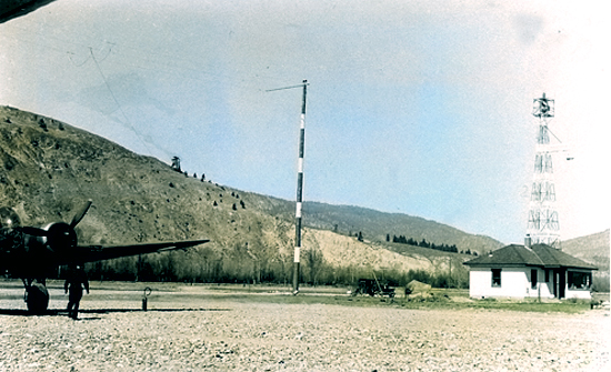
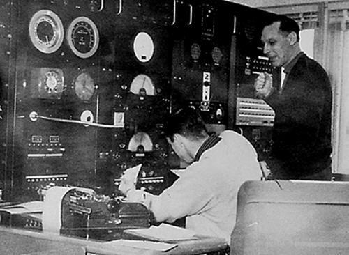
Trans Canada Airlines moved its
radio communications station, shown here, from Oliver to
Penticton in February 1941. Other improvements included
airport lighting and a radio range navigation station to
support instrument approaches. DOT continued to operate the
airfield throughout the war, mainly for RCAF and other
military flights.
Back to top of
page
Return to
map
. |
RCAF Number 124
Ferry Squadron established a detachment to
service itinerant flights, and in 1943 the
Department of National Defence funded an
extension of the runway to 5300 feet, along with
construction and paving of a taxiway. The 1943
aerial photo (looking north) shows significant
development over the previous year to
accommodate the military operations, like those
in the following photo of RCAF facilities at the
field.
|
. |
A temporary civil operating licence in the name
of DOT was issued in November 1945, allowing
rapid introduction of scheduled services by both
Trans Canada Airlines and Canadian Pacific
Airlines. A permanent licence was granted in
May 1954 and the runway extended to 6000 feet in
1959. A terminal building was opened in 1963.
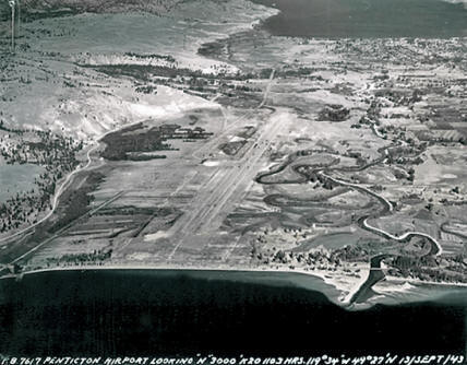
The 1965 aerial photo clearly shows the further
development of the field following the war. A
temporary control tower was installed in 1969
and a permanent one opened in 1971. In 1976 a
privately owned aviation centre was constructed
on the airport.
Back to top of
page
Return to
map
. |
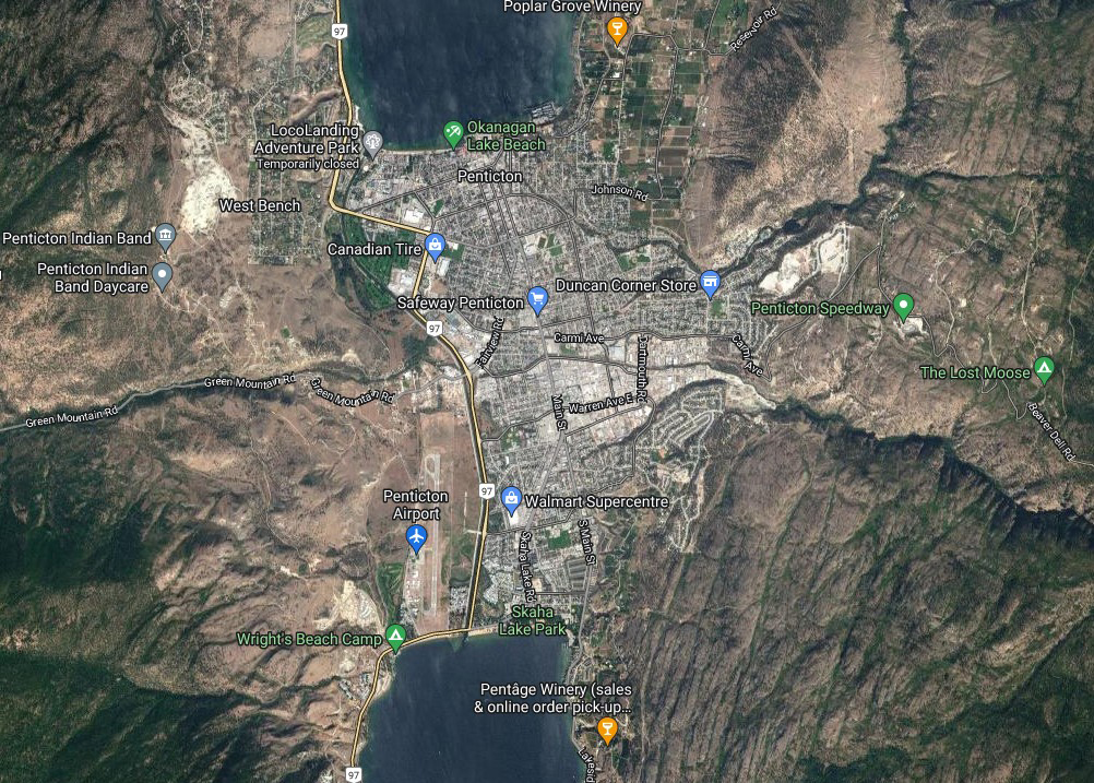 |
Penticton Airport continues to
be owned and managed by Transport Canada. Its current
tenants include the Penticton Flying Club, a helicopter
training centre, forestry air tanker base, and full aircraft
servicing capability. Air Canada Express, Cascadia Air,
Pacific Coastal Airlines and WestJet Encore all offer
scheduled flights to Vancouver, Calgary and Edmonton (as of
June 2022).
Owner
ship of the land, originally expropriated by the federal
government from the
SnPink'tn
in 1941 and further expanded in 1946, remains a contentious
and unresolved issue for the Band.
Back to top of
page
Return to
map
Note: Photos
courtesy Chris Weicht except for final aerial view courtesy
Google Maps
 �
British Columbia Aviation Museum Updated:
2023-01-16 �
British Columbia Aviation Museum Updated:
2023-01-16
|